A route around Neustadt, the air and health spa town.
The route initially leads southwest and ascends over meadows to Galgenberg, an execution site from the 18th century, and the weather vane built in 1888. From there, beautiful views open up of the South Harz, the charming spa town of Neustadt, and the Hohnstein castle ruins.
Continue on the South Harz steam locomotive trail to the Harz wooden steam locomotive (stamp point HWN No. 99). After briefly following the path southwest, take a left at the fork and then a right at the next signpost into Markttal. The marked route continues southwest through woods until just before Rüdigsdorf, where it meets the Karstwanderweg. From there, it continues east into the wooded heights of the Harzfelder Holz up to the forest edge, where a shelter and information board invite you to rest. The path now leads north through a wooded karst valley. In the valley hollow, it turns after a short stretch at the state road into the valley of the Harzfeldgraben. (Here the road must be crossed twice, taking traffic conditions and signage into account).
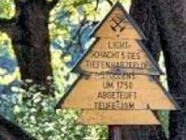
At the edge of the forest, south of the path lies the church ruin of the former village of Harzfeld. The village lay in the valley by the stream. Between the field path and the forest edge lie numerous dumps and sinkholes from the copper shale mining. The so-called "Deep Harzfelder Vein" ran along here, with its minable ores at a depth of about 60 m. The light shaft north of the church ruin was the fifth shaft on this vein, a term describing the outcrop of the seam. The soft waters flowing down from the Harz leached out a Harz-edge-parallel valley, the subrosion hollow. Here in the valley of the Harzfeldgraben and on the opposite valley side there is no longer any gypsum; it has already been dissolved. This formed a steep valley slope of the leaching valley, the so-called leaching front. The dissolution of this remaining karst wall, however, continues. This process is noticeable on the surface through large subsidence and dissolution funnels, which as dolines connect into contiguous valleys, the uvalas. The route initially continues west along the Harzfeldgraben. Follow the signage north back over the Galgenberg to the Wiesenplatz in Neustadt.

