© Oberharzer Bergwerksmuseum, UNESCO-Welterbe Bergwerk Rammelsberg, Altstadt von Goslar und Oberharzer Wasserwirtschaft

WatersideWalk Lautenthaler Kunstgraben

Short facts

  • start: Wildemann: Parking lot at the lower end of the town on the L515 in the direction of Lautenthal
  • destination: Lautenthal: Waldkater car park on the L516 Lautenthal - Hahnenklee
  • medium
  • 9,51 km
  • 3 hours
  • 424 m
  • 357 m

best season

Hike along a water transport ditch from Wildemann to Lautenthal.

The water transport ditch was constructed in the 16th century. It was used to transport water from Wildemann to the mines in Lautenthal.

The mines were quite high up on the mountains. Therefore the water had to come from even higher. The Lautenthaler Kunstgraben ditch winds along steep slopes.

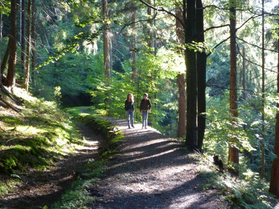
The path next to the ditch was once used for maintenance of the ditch. Today it is an excellent hiking path. In many places there are fantastic views of the Innerste Valley.

For example from the "Siebenwochenklippe".


The hiking route is 9.5 km long. The signboards along the way will tell you more about the Lautenthaler Kunstgraben.

On the path you can even see how the ditch was built in various stages. And you will learn how the water was used in the mines.

Tour-Dashboard

Pavings

  • Asphalt Coating (46%)
  • Hiking Trail (22%)
  • Path (26%)
  • Crushed Rock (6%)

Weather

General information

Next steps
Download GPX Tour-Portal

More like this

It appears that you are using Microsoft Internet Explorer as your web browser to access our site.

For practical and security reasons, we recommend that you use a current web browser such as Firefox, Chrome, Safari, Opera, or Edge. Internet Explorer does not always display the complete content of our website and does not offer all the necessary functions.