The Monastery Route connects the monasteries of Lamspringe and Brunshausen, it runs over the ridge "Heber" located west of the Harz foothills. Sections of the Monastery Route lie on the European long-distance path E11.
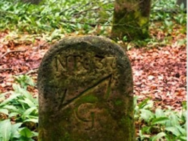
The Monastery Route runs mostly along the crest of the Heber; here once lay the border between the local territorial powers, the Duchy of Brunswick and the Bishopric of Hildesheim (until 1814) or the Kingdom of Hanover (from 1814). This former national border, which today is a district boundary, is still clearly marked by mostly well-visible boundary stones made of limestone or sandstone. These are deeply embedded in the ground and carry on the Hildesheim/Hanover side the letters B (Bishopric of Hildesheim) or KH (Kingdom of Hanover) and a sequential number, and on the Brunswick side HB (Duchy of Brunswick) and a Wolfsangel symbol as well as a number. There are also numerous boundary stones bearing the abbreviations AB for the Hildesheim district Bilderlahe or AG for the Brunswick district Gandersheim, as well as boundary stones with a chalice and an L for Lamspringe Monastery. In some cases, two boundary stones facing each other line the border path, intended to make the border "more secure" against secret border shifts. All boundary stones are cultural monuments protected as heritage sites!


